Day Hikes Of Zion National Park folds into a nice, waterproof, portable guide to Zion's day hikes/hike734
You're planning a trip to Zion National Park in Utah, you plan to do some hiking, and you're wondering which trails to search out.
You could pick up a copy of 50 Best Short Hikes In Utah's National Parks, which would be a good start in identifying some hikes in Zion. But a new "map guide" from Jake Bramante, the guy who hiked all 734 miles of Glacier National Park in one year, would be a good investment, too, if you're solely interested in day hiking in the park.
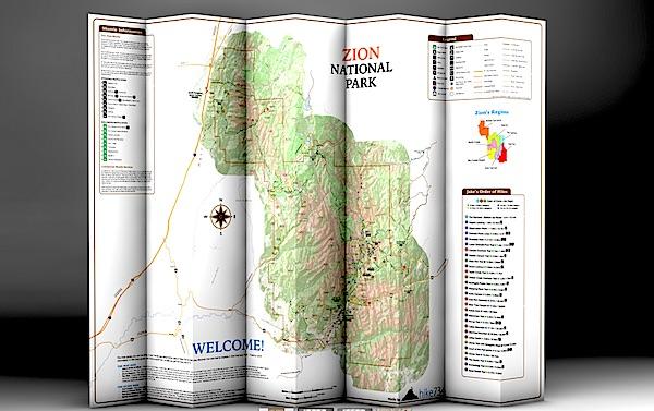
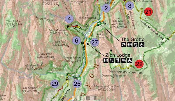
Day Hikes of Zion National Park, which provides details on 29 hikes in the park, is printed on tear-resistant, waterproof paper that folds down to a roughly 4.5-inch by 9-inch brochure that you can stuff in your back pocket or day pack. Unfold it and you find a map of the park with key facilities (restrooms, visitor center, lodging, picnic areas, etc) marked along with numbered hikes. Shuttle bus stops in the park as well as neighboring Springdale also are numbered to help you catch a ride.
This map is similar to Bramante's Day Hikes Of Glacier National Park. Hikes in the Zion guide are color-coded by region in the park. So if you look at all the purple-coded hikes, you'll know they're in the same general area of the park; in this case, in Zion Canyon. Green circles denote trails on the West Rim, violet is tagged to those on North Creek, yellow indicates southwest desert, light blue is The Narrows, and red is Kolob Canyons and the East Rim. Lines denoting the trails are even color coded: green for easy, yellow for moderate, and red for strenuous.
The map color codes hikes by region, and uses more colors to denote easy, moderate, and strenuous hikes/hike734
A glance at "Jake's Order of Hikes, which lists his favorites in descending order, tells you whether you'll encounter steep cliffs, whether a particular hike is family friendly, and whether the trail is accessible.
On the back of the map you'll find a breakdown of the trails with descriptions. Here Bramante segregated the hikes by distance, so you can quickly identify the mileage so you don't overdo it. You'll also find a box of safety information, ranging from steep cliffs in the park to the need to drink lots of water in this desert setting and even symptoms of heat stroke.
There's even a small box of information on where you can obtain additional books and maps.
If day hiking is your goal, this is a good tool to help you plan, and pull off, your day-long journeys in Zion. You can order a copy at Mr. Bramante's website.


Comments
Going in a couple of weeks. I see it is available at the VC but was hoping to get a copy earlier. Is there a place to buy online?
So much for quality control, eh, EC?
Just added a line for ordering: www.hike734.com
Ordered. Thanks
Off topic - but about the Parks. Planning a trip on the CDT in RMNP this summer. Trying to figure out an iternary through the backcountry sites. I can't find anywhere where the site GPS coordinates are listed. As I search, I see alot of commentary about GPS coords not being available for NPS locations. Does the NPS have a policy of not making those available? Shouldn't this be part of the basic info available on the websites? Would appreciate comments from anyone with insights.
Can't speak for other National Parks and GPS coordinates, but we've found Acadia posting some coordinates, some of which we've referred to in updating our latest edition of "Best Easy Day Hikes, Acadia National Park."
By searching "GPS coordinates" in the Acadia search field, we found this link:
http://www.nps.gov/acad/planyourvisit/gpscoordinates.htm
Maybe same search term would work for RMNP.
That is a start Acadia but it doesn't cover the backcountry campsites. Nor is it in a GPX file.
EC, I'm guessing the NPS doesn't have the staff or $$$ to go out and generate GPS coordinates for its trails. That said, I wonder if the relatively low traffic numbers along the CDT are behind the lack of some commercial GPS program. I noticed Garmin, I believe, or maybe it was DeLorme, had GPS packages for some other long-distance trails.
I find that hard to accept. I am assuming the rangers hike the trails and visit the campsites on a frequent basis. How much time/$$$ would it take to "mark" while on the way. I would think they would want that information for their own uses.