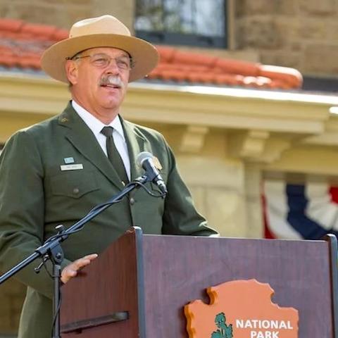
National Park Service Can't Say How Many Superintendent Vacancies It Has

While the National Park Service, and other federal agencies, are in a state of turmoil under the administration's push to drastically shrink the size of government, the agency has no idea how many vacant superintendent positions exist across the... THE WHOLE STORY

National Parks Traveler Podcast Episode 313 | National Parks in Crisis

The Trump administration’s determination to reduce the size of government regardless of the cost is having a hard impact on the National Park Service.Last month the agency was forced to rescind job offers to seasonal workers, saw a hold placed on... THE WHOLE STORY

  • A frame-filling shot of a Mariposa Lily, a 3-petaled cream-colored lily with a green, cream, and purple center, Black Canyon of the Gunnison National Park
    Mariposa Lily, Black Canyon Of The Gunnison National Park
    Black Canyon of the Gunnison National Park - National Park Service

    Wildflowers and flowering shrubs found at Black Canyon bloom in early season (April–June), mid-season (June–July), and late season (July–September). They grow on the canyon rim, uplands, and the inner canyon. Mariposa lilies are native to Western North America. 

  • A quirky least bittern straddling long green cattail at a wetland in Cuyahoga Valley National Park
    Least Bittern Straddling The Cattails, Cuyahoga Valley National Park
    Cuyahoga Valley National Park - Rick McMeechan via NPS

    Cuyahoga Valley National Park's diverse landscape provides habitat for about 250 species of birds, including this quirky least bittern pictured here.

  • A rock climber hanging onto the steep, pegmatite-veined cliff wall at Black Canyon of the Gunnison National Park
    Scaling The Cliff, Black Canyon Of The Gunnison National Park
    Black Canyon of the Gunnison National Park - NPS/Lisa Lynch

    The cliffs of Black Canyon are a siren call to rock climbers, but this place is not to be lightly tackled by beginners. To read more about rock climbing at this national park in Colorado, click here.

  • A tree-lined portion of the Cuyahoga River with kayakers pushing off from a pebbly beach at Cuyahoga Valley National Park
    Preparing To Kayak The Cuyahoga River Water Trail, Cuyahoga Valley National Park
    Cuyahoga Valley National Park - NPS/D.J. Reiser

    Twenty-five miles (40 km) of the river’s 100 miles (161 km) run the length of the park from south to north, so it’s a no-brainer to want to paddle a canoe or kayak through the park on this waterway. Click here to read more about paddling the Cuyahoga River.

  • A bird called the canyon wren balancing precariously on a rock on a steep slope, Black Canyon of the Gunnison National Park
    Canyon Wren, Black Canyon Of The Gunnison National Park
    Black Canyon of the Gunnison National Park - NPS/D. Goodman

    Black Canyon is home to 174 bird species, including this canyon wren.

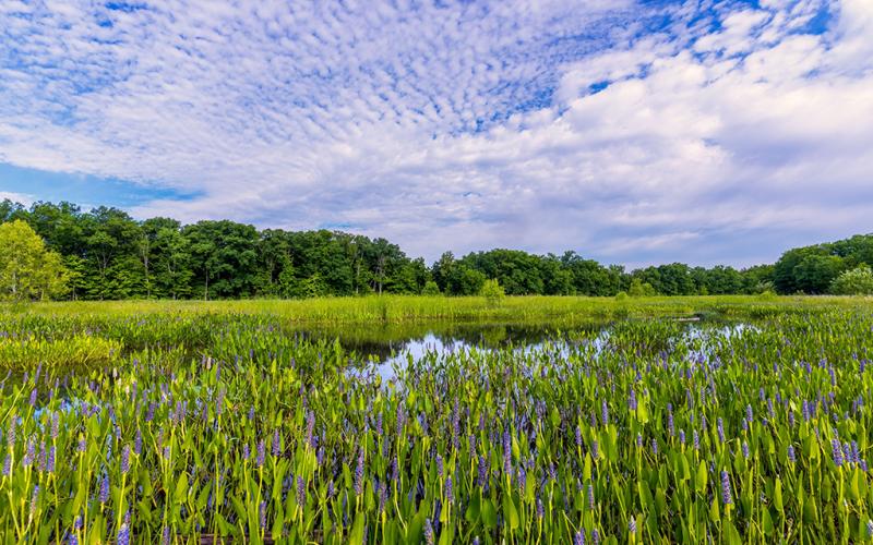
  • A blue sky with white clouds over a wildflower-filled wetland, Cuyahoga Valley National Park
    Krejci Wetland, Cuyahoga Valley National Park
    Cuyahoga Valley National Park - Jim Roetzel via NPS

    From Superfund Site to environmental success story, Krejci was once a salvage yard and waste disposal facility. Cuyahoga Valley National Park acquired the land and began the task of cleanup. Click here to read more about this.

  • People standing within a small fenced area overlooking the Black Canyon at Black Canyon of the Gunnison National Park
    The View From Gunnison Point Overlook, Black Canyon Of The Gunnison National Park
    Black Canyon of the Gunnison National Park - National Park Service

    According to the National Park Service, "Black Canyon is the result of multiple episodes of uplift and erosion and the carving power of the Gunnison River. The canyon displays a wide variety of rock types - including igneous, metamorphic, and sedimentary."

  • A wide-angle view of Black Canyon with the thin line of the Gunnison River far below on a hazy day, Black Canyon of the Gunnison National Park
    Chasm View of the Gunnison River, Black Canyon of the Gunnison National Park
    Black Canyon of the Gunnison National Park - NPS/Lisa Lynch

    "Deep, steep, and narrow." According to the National Park Service, Black Canyon exposes nearly two billion year old Precambrian "basement rocks," one of the best examples in the world.

  • A black-and-white photo of CCC camp buildings and the dirt road around the buildings in the Chisos Basin of Big Bend National Park
    An Aerial View Of The CCC Encampment In The Chisos Basin During The 1930s At Big Bend National Park (Texas)
    Big Bend National Park - National Park Service

    This first month of the 2025 New Year is all about throwback in the National Park System, with a little added trivia.

    When driving the Chisos Basin Road toward the Chisos Mountains and the Chisos Mountains Lodge, think about the young men of the Civilian Conservation Corps (CCC). They built the road. 

    According to park staff:

    "In May 1933, Texas Canyons State Park was established; it was later renamed Big Bend State Park. Roads and trails were needed for the new park, and the CCC provided an ideal workforce. A year after the park was established, 200 young men, 80 percent of whom were Hispanic, arrived to work in the Chisos Mountains. The CCC's first job was to set up camp and develop a reliable water supply. The CCC boys faced many challenges, living in tents 85 miles from the nearest town, and facing extreme temperatures and weather. Eventually barracks replaced tents in the area of today’s Basin Campground."

    "The CCC built an all-weather access road into the Chisos Mountains Basin. They surveyed and built the seven-mile road using only picks, shovels, rakes, and a dump truck, which they loaded by hand. They scraped, dug, and blasted 10,000 truck loads of earth and rock and constructed 17 stone culverts, still in use today along the Basin road."

  • A black-and-white 1917 image of Paradise Inn and surrounding tent cabins up at Mount Rainier National Park
    A 1917 View Of Paradise Inn And Tent Cabins, Mount Rainier National Park
    Mount Rainier National Park - National Park Service

    This first month of the 2025 New Year is all about throwback in the National Park System, with a little added trivia.

    Did you know that when Paradise Inn opened for business in 1917 up at Mount Rainier National Park in Washington State, there were tent cabins there, too? According to Mount Rainier Guest Service's history page for the Paradise Inn:

    "In early 1895, a coffee shop called the Paradise Hotel and a tent camp were established providing services to the ever-increasing numbers of people visiting the area, and in 1898; John L. Reese combined the two operations and name it Camp of the Clouds. Although visitors were generally satisfied with the camp, they wanted nicer accommodations and the demand for better sanitation increased in 1911, the first full season that it was possible to take horse-drawn vehicles all the way to the Camp of the Clouds. As the need increased for a hotel and other services in the Paradise area, a corporation of local Tacoma businessmen from Tacoma formed the Rainier National Park Company (RNPC) and began construction of the Paradise Inn. John Reese sold his camp to RNPC in 1916 to house construction crews as they worked on the new first-class Paradise Inn. In spite of the short construction season, the crew nearly completed the Paradise Inn during the summer of 1916 at an initial cost of $91,000, not including furnishings or equipment." The tent cabins were ultimately removed in 1930.

  • A 1930 black-and-white image of people sitting on the edge of the Don Patricio Causeway, fishing the saltwater at Padre Island National Seashore
    Fishing From The Don Patricio Causeway Circa 1930, Padre Island National Seashore (Texas)
    Padre Island National Seashore - National Park Service

    This first month of the 2025 New Year is all about throwback in the National Park System, along with a little added trivia.

    According to Padre Island National Seashore staff, "When Colonel Sam Robertson bought out Pat Dunn's interests (except for grazing and mineral rights) on the island, he envisioned developing Padre Island into the Miami Beach of the Texas coast. To that end he developed several projects to bring people to the island and which still exist, although not in their original form."

    "In 1927 Colonel Robertson built the first causeway from the island's northern end to Flour Bluff on the mainland. He named it the Don Patricio causeway in honor of Patrick Dunn. The construction was very simple: four wooden troughs supported by a trestle. The troughs were spaced so that a standard automobile could place it tires in them and drive across. One pair of troughs was for eastbound traffic and one was for westbound. In the first month of its operation, 1,800 cars used the causeway and 2,500 used it the second month. After that use dropped."

    Looks like the Don Patricio Causeway in this 1930 image was more popular as a spot for saltwater fishing.

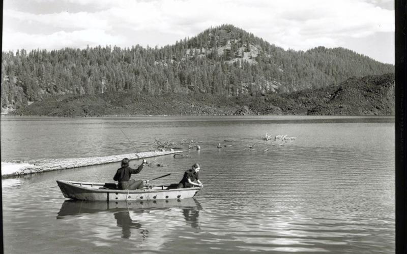
  • A black-and-white photo circa 1941 of two women in a boat fishing on Butte Lake in Lassen Volcanic National Park
    Women Fishing On Butte Lake In 1941, Lassen Volcanic National Park (California)
    Lassen Volcanic National Park - National Park Service

    This first week of the New Year is all about a little throwback with national park photos from years past, along with a little trivia. 

    According to Wikipedia: "The irregularly-shaped lake lies at the northern end of Cinder Cone and the Fantastic Lava Beds, which is a complex of lava flows and a cinder cone. Lava from Cinder Cone's 1666 eruption flowed into and around the lake. This formed an underwater lava field. Water from Snag Lake to the south flows through the porous lava field to Butte Lake. Water from Butte Lake drains via Butte Creek, which flows north out of the parkland.

    Do you wonder what fish those two women caught? Maybe rainbow, brown, or brook trout.

  • A 1933 image of CCC workers banking a slope for hillside stabilization at the Zion-Mt. Carmel Highway just below the tunnel
    1933 CCC Workers Working On Slope Stabilization Of The Zion-Mt. Carmel Highway, Zion National Park (Utah)
    Zion National Park - National Park Service

    "In about anything they needed as extra manpower, they always relied on the CCC…. I mean, you can just see the results. I don’t think they would have a lot of things today if they hadn’t had the CCC working on these, you know a lot of this rock cribbing and river work and the trail work and just things like that. They got a lot done. It makes the park…I’ll say."
     

    - Fred Brueck, Zion and Bryce National Park Ranger 1934-1941 and Zion National Park Chief Ranger 1953-1973. Interviewed September 18, 1989.

  • A black-and-white image of a 1914 eruption of Mount Lassen, Lassen Volcanic National Park
    A 1914 Eruption Of Lassen Peak, Lassen Volcanic National Park (California)
    Lassen Volcanic National Park - USGS/B.F. Loomis

    This first week of the New Year is all about a little throwback with national park photos from years past, along with a little trivia. 

    Photographer B.F. Loomis captured many images during and after the 1914 and 1915 eruptions of Lassen Peak, and these photos and the unique nature of the volcano and active volcanic landscape around it encouraged Congress to establish Lassen Volcanic National Park on August 9, 1916.

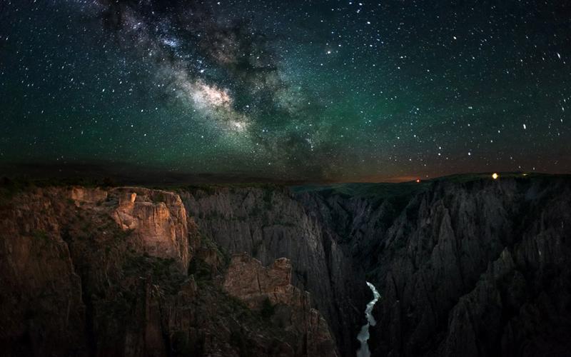
  • A dark sky with a bright Milky Way over the Black Canyon of the Gunnison National Park
    A Bright Milky Way And Starry Sky Over Black Canyon Of The Gunnison National Park
    Black Canyon of the Gunnison National Park - NPS/G. Owens

    According to the National Park Service, "Due to its exceptional night skies and efforts to mitigate light pollution, Black Canyon of the Gunnison National Park was designated as an International Dark Sky Park in 2015."

  • The first class of Tuskegee Airmen Cadets walking away from their Stearman planes,
    The 1942 First Class Of Tuskegee Airmen Cadets, Tuskegee Airmen National Historic Site (Alabama)
    Tuskegee Airmen National Historic Site - National Park Service

    This week park's photos are all about a little throwback to start the New Year off, with a little bit of trivia included.

    Before the first African American military pilots became known as the "Red Tails" they wore striped tails as they began their flight training in the Army's PT-17 Stearman bi-plane.  Their flying adventure started at Moton Field, in Tuskegee, Alabama, where the Army Air Corps conducted a military test to determine if African Americans could be trained to fly combat aircraft. At the far left is Captain Benjamin O. Davis, Jr., the squadron commander, who went on to a long, successful career in the U.S. Airforce.

  • An old black-and-white image of Model-T cars parked at the Visitor Center for Lehman Caves tours, Great Basin National Park
    Parked At The Visitor Center For Lehman Caves Tours At Great Basin National Park (Nevada)
    Great Basin National Park - NPS - Thomas J. Kearns

    How about a little throwback this week of National Park images captured in past years. The year for this image is unknown, but given the vintage make of these vehicles (Model T's?), it looks like the 1930s - 1940s. This is the Lehman Caves Visitor Center and all these cars are parked while their occupants take a tour of Lehman Caves, the longest cave system in the state of Nevada and located in Great Basin National Park.

  • An old colorized postcard photo of the crowds at Logan Pass for the dedication of Going-to-the-Sun Road in Glacier National Park
    1933 Dedication Ceremony For Going-To-The-Sun Road, Glacier National Park (Montana)
    Glacier National Park - National Park Service

    Happy New Year! How about a little throwback this week of National Park images captured in past years. For the start of this week, here is a colorized post card image of the 1933 ceremony held up at Logan Pass for the dedication of the newly-constructed Going-to-the-Sun Road. This 50-mile (80.5 km) road runs from east to west (or west to east) across Glacier National Park in Montana. At Logan Pass, it crosses over the Continental Divide.

  • A line of cross-country skiers being led over the snow by a ranger at Lassen Volcanic National Park in California
    Cross-Country Skiing Over Winter Snow, Lassen Volcanic National Park, California
    Lassen Volcanic National Park - National Park Service

    Although all the roads in Lassen Volcanic National Park are closed for the winter, with the exception of a little bit on both north and south ends of the scenic park highway, that doesn't mean getting out and enjoying winter in this national park is not possible. Visitors in the winter will enjoy solitude and no crowds and can sled, snowshoe, and ski over the snow-blanketed landscape.

  • Green bristlecone pine needles have a distinguishing "bottle brush" look to them, Great Basin National Park, Nevada
    The "Bottle Brush" Look Of Bristlecone Pine Needles, Great Basin National Park, Nevada
    Great Basin National Park - Rebecca Latson

    A visit to Great Basin National Park in Nevada is not complete without hiking the 2.8-mile (4.5 km) Wheeler Bristlecone Trail up 10,000 feet (3,048 m) to see a grove of ancient bristlecone pines, some of which are several thousand years old. Bristlecone pines can be distinguished from other pines such as the limber pine by the "bottle brush" shape of the needles around a branch, some of which extend back as far as a foot or more along the branch.

  1. 1
  2. 2
  3. 3
  4. 4
  5. 5
  6. 6
  7. 7
  8. 8
  9. 9
  10. 10
  11. 11
  12. 12
  13. 13
  14. 14
  15. 15
  16. 16
  17. 17
  18. 18
  19. 19
  20. 20