National Parks Traveler Podcast Episode 270 | Cultural Resource Challenge

Spur a discussion about traveling to a national park for a vacation and odds are that it will revolve around getting out into nature, looking for wildlife, perhaps honing your photography skills, or marveling at incredible vistas.Will the discussion... LISTEN NOW

  • The view from San Luis Lakes State Wildlife Area toward a broad, flat valley below a distant dunefield and mountains beneath a blue sky, Great Sand Dunes National Park and Preserve
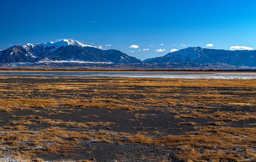
    A View Of Great Sand Dunes National Park And Preserve From San Luis Lakes State Wildlife Area
    Great Sand Dunes National Park and Preserve - Rebecca Latson

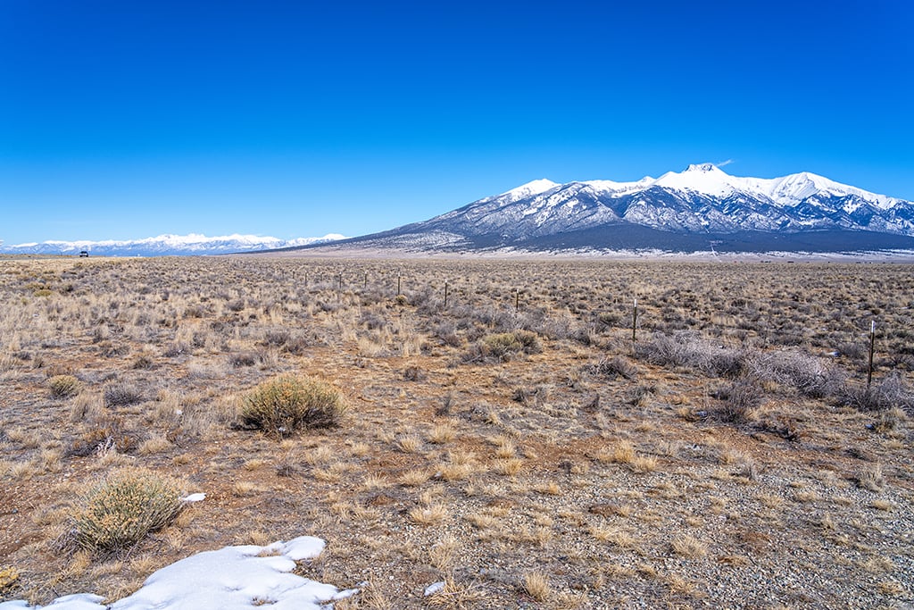
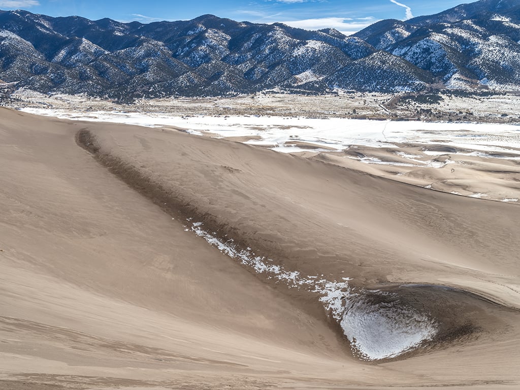
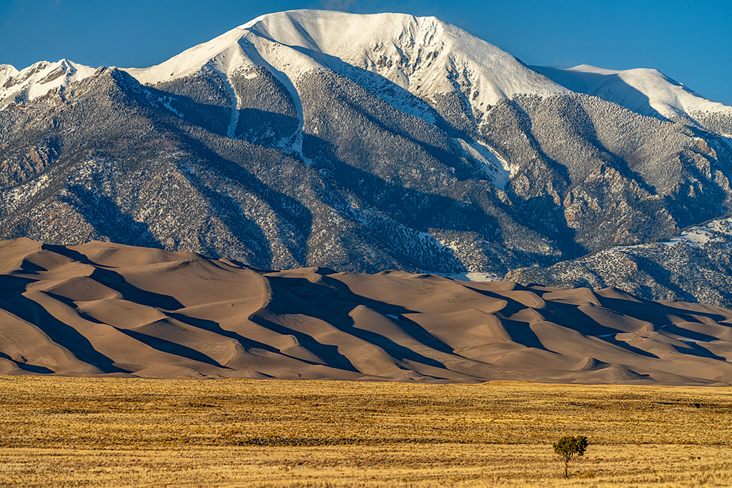
    If you are interested in the geology of Great Sand Dunes National Park and Preserve, a great place to view the overall geologic system of the park is from San Luis Lakes State Wildlife Area just off of Lane 6 N, almost halfway between the community of Mosca and the turnoff onto Colorado State Highway 150 toward the park. From this vantage point, you can see all four primary components of the Great Sand Dunes geological system: mountain watershed, dunefield, sand sheet, and sabkha. Depending upon your time of visit, you might also be lucky enough to see thousands of sandhill cranes stopping off for a rest during their migration.

  • A vast panorama of road (CO Hwy 150) to the far left, a broad swath of scrub brush and San Luis Valley, and mountains (including Blanca Peak) to the right, highlighting a portion of the route of the Old Spanish National Historic Trail
    The Route Of The Old Spanish National Historic Trail
    Old Spanish National Historic Trail - Rebecca Latson

    What do you see in this image? A broad valley covered in scrub brush with a lone vehicle on a stretch of highway to the left of the shot, and rugged, snowcapped mountains to the right. This route is a part of a network of trails from Santa Fe, New Mexico to Los Angeles, California, now all a part of the Old Spanish National Historic Trail, "where New Mexican traders moved locally produced merchandise across what are now six states to exchange for mules and horses." This part of the trail parallels Colorado State Highway, skirting Great Sand Dunes National Park and Preserve and continuing in a north-northwest direction.

  • A view from a tall sand dune looking out toward the east, across the snow-covered expanse of flat land where frozen Medano Creek usually flows, Great Sand Dunes National Park and Preserve
    The View From A Tall Sand Dune, Great Sand Dunes National Park And Preserve
    Great Sand Dunes National Park and Preserve - Rebecca Latson

    Hike to the top of any sand dune within this national park and you've got a great view of the land below and beyond. In this image, you see the Sangre de Cristo Mountains to the east, with the flat, snow-covered flat expanse of land below where Medano Creek will flow during spring and summer. Look closely enough and you might even be able to see the trail in the snow created by hikers leaving the parking area and heading toward the dunefield.

  • A telephoto view of a snowcapped mountain towering over a dunefield sitting on a flat expanse of land, Great Sand Dunes National Park and Preserve
    Mountains, Dunefield, And Sand Sheet, Great Sand Dunes National Park And Preserve
    Great Sand Dunes National Park and Preserve - Rebecca Latson

    There are four primary components to the Great Sand Dunes geological system: mountain watershed, dunefield, sand sheet, and sabkha. To read more about this, click here.

  • Three images showing a magnet in a black patch of sand on a sand dune at Great Sand Dunes National Park and Preserve
    A Magnet On A Sand Dune, Great Sand Dunes National Park and Preserve
    Great Sand Dunes National Park and Preserve - Rebecca Latson

    How many of you have hiked the dunes at Great Sand Dunes National Park and Preserve and noticed black patches or black ripples in the otherwise beige palette of the soft sand? What you are seeing are black magnetite grains in the sand. Magnetite is magnetic, and if you place a magnet on the sand, you'll pick up clumps of black magnetite grains. For real, and not an April Fool's joke! Cool, right?

  • A pre-sunrise autumn view of Mount Rainier seen from the Paradise area of Mount Rainier National Park
    "The Mountain" Is Out, Mount Rainier National Park
    Mount Rainier National Park - Rebecca Latson

    On a clear, sunny day when 14,410-feet-tall Mount Rainier may be seen from miles away, the locals will tell you "The Mountain is out, today."

  • Visitors walking along the Avenue of Flags with Mount Rushmore in the background.
    Walking The Avenue Of Flags At Mount Rushmore National Memorial
    Mount Rushmore National Memorial - National Park Service

    "Majestic figures of George Washington, Thomas Jefferson, Theodore Roosevelt and Abraham Lincoln, surrounded by the beauty of the Black Hills of South Dakota, tell the story of the birth, growth, development and preservation of this country. From the history of the first inhabitants to the diversity of America today, Mount Rushmore brings visitors face to face with the rich heritage we all share."

  • Two visitors walk on a trail facing a large brown rock buttress, a paved path leads to three exhibits at Split Rock Viewpoint, Mormon Pioneer National Historic Trail
    Split Rock Viewpoint, Mormon Pioneer National Historic Trail
    Mormon Pioneer National Historic Trail - National Park Service

    The 1,300-mile Mormon Pioneer National Historic Trail is not a single hiking trail but rather, a route traveled by Mormons who fled Nauvoo, Illinois, to the Great Salt Lake Valley in 1846-1847. Along this route you can see some amazing landscapes while learning about this route and the hardy people who traveled it.

  • A ranger canoeing along the Mississippi River, Mississippi National River And Recreation Area
    Canoeing The River, Mississippi National River And Recreation Area
    Mississippi National River and Recreation Area - NPS - Kyle Just

    "In the middle of a bustling urban setting, this 72 mile river park offers quiet stretches for fishing, boating and canoeing, birdwatching, bicycling, and hiking. And there are plenty of visitor centers and trails that highlight the fascinating human history of the Mississippi River."

  • The hearth of a home at Morristown National Historical Park
    The Hearth Of A Home, Morristown National Historical Park
    Morristown National Historical Park - National Park Service

    "Kitchens were one of the busiest rooms in the home not just for cooking of meals, but also washing of laundry."

  • Mescal Historic Mining District at Mojave National Preserve
    Mescal Historic Mining District At Mojave National Preserve
    Mojave National Preserve - National Park Service

    "The Mescal Historic Mining District was a small-scale producer of tungsten and tin in the Mojave Desert, and produced tin for domestic World War II stockpiles. Due to the temporary nature of mining activity on the site, some of the features have deteriorated, but the character and significance of the site remains strong."

  • The cliff dwelling ruins of Mug House in the backcountry of Mesa Verde National Park
    The Cliff Dwelling Ruins Of Mug House, Mesa Verde National Park
    Mesa Verde National Park - Rebecca Latson

    Mug House, built around 1,100 - 1,200 AD, was so named from the discovery of three pottery mugs tied together with a rope and hanging in one of the rooms of this cliff dwelling in Mesa Verde National Park.

  • Group of cavers sitting in passageway with headlamps on, Mammoth Cave National Park
    Cavers On The Trog Tour, Mammoth Cave National Park
    Mammoth Cave National Park - NPS - Ashley Decker

    "Rolling hills, deep river valleys, and the world's longest known cave system. Mammoth Cave National Park is home to thousands of years of human history and a rich diversity of plant and animal life, earning it the title of UNESCO World Heritage Site and International Biosphere Reserve."

    Cave tours are a unique and immersive way to understand and safely explore Mammoth Cave. You can go to the website to learn more about tours, tickets, and times.

  • An aerial view of Fort Jefferson at Dry Tortugas National Park off the coast of Florida
    Fort Jefferson From Above, Dry Tortugas National Park
    Dry Tortugas National Park - National Park Service

    "Fort Jefferson, the largest all-masonry fort in the United States, was built between 1846 and 1875 to protect the nation's gateway to the Gulf of Mexico. Supply and subsidence problems and the Civil War delayed construction. The fort was never completed because of fears that additional bricks and cannon would cause further settling and place more stress on the structure and the cistern system. Distinguishing features include decorative brickwork and 2,000 arches. Time, weather, and water continue to take their toll, necessitating ongoing stabilization and restoration projects."

  • And bird's eye view of the grounds of Fort Stanwix National Monument.
    A Bird's Eye View Of Fort Stanwix National Monument
    Fort Stanwix National Monument - National Park Service

    "For centuries, the Oneida Carrying Place, a six mile portage connecting the Mohawk River and Wood Creek, served as a vital link for those traveling by water from the ocean to the Great Lakes. When Europeans arrived, nations fought for control of the carry, the homelands of the Six Nations Confederacy, and the rich resources of North America. In this struggle, Fort Stanwix would play a vital role."

  • A small fort surrounded by tall green grass with a line of trees in the background beneath fluffy clouds in a blue sky, Fort Necessity National Battlefield.
    A Fine Sunny Day At Fort Necessity National Battlefield
    Fort Necessity National Battlefield - NPS - Victoria Stauffenberg

    "The battle at Fort Necessity in the summer of 1754 was the opening action of the French and Indian War. This war was a clash of British, French and American Indian cultures. It ended with the removal of French power from North America. The stage was set for the American Revolution."

  • An aerial view looking north at a fort located at an oxbow bend of a river, Fort Laramie National Historic Site
    An Aerial View Of Fort Laramie National Historic Site
    Fort Laramie National Historic Site - John Gilpin via NPS

    "Originally established as a private fur trading fort in 1834, Fort Laramie evolved into the largest and best known military post on the Northern Plains before its abandonment in 1890. This 'grand old post' witnessed the entire sweeping saga of America’s western expansion and Indian resistance to encroachment on their territories."

  • Fort from a distance across maritime hammock and salt marshes, Fort Matanzas National Monument
    A View Of Fort Matanzas National Monument, Florida
    Fort Matanzas National Monument - National Park Service

    "Throughout its history, the story of Fort Matanzas has been closely intertwined with that of the city of St. Augustine and the Castillo de San Marcos. This Spanish outpost fort was built in 1740-1742 to guard the Matanzas Inlet and to warn St. Augustine of British or other enemies approaching from the south. Fort Matanzas now serves as a reminder of the early Spanish empire in the New World. In addition, the park, which is located on barrier islands along the shores of the Atlantic Ocean and the Matanzas estuary, provides a natural habitat rich in wildlife with the salt marsh, scrub, and maritime hammock now protecting endangered and threatened species like the historic Fort Matanzas protected St. Augustine long ago."

  • A view from a somewhat spotted window of the Bastion looking out onto the grounds of Fort Vancouver National Historic Site.
    A View Of The Grounds From A Window In The Bastion, Fort Vancouver National Historic Site
    Fort Vancouver National Historic Site - Rebecca Latson

    According to the National Park Service, "In the northwest corner of Fort Vancouver's protective palisade wall, a three-story tower called a bastion or blockhouse rose above the surrounding plain. From the top, Hudson's Bay Company (HBC) employees could keep watch over the Columbia River valley and its gently rolling hills. The bastion was a common feature of HBC posts throughout North America. They typically had open slits or windows through which guns and cannons could be aimed at attacking enemies ... Though Fort Vancouver's bastion never saw any real military action it was still certainly an imposing structure. The tower, shaped like an octagon, was built into the northwest corner of the palisade. It stood three stories tall and was capped with a pointed roof. It was the tallest building at the fort. At the top level, eight three-pound iron guns pointed through small windows in each of the bastion's eight sides. When not in use, the windows were shuttered. The entrance on the ground level was probably on the bastion's southeast wall since that was the only side accessible from inside the fort. When the HBC left Fort Vancouver, the bastion fell into disrepair along with the rest of its buildings. Sometime after 1860, it burned to the ground. While it stood, however, the bastion was an important part of Fort Vancouver's image, and a key way that the HBC projected strength in a tangible, visible way."

  • An aerial view of a fort surrounded by water with a marina on one side and a beach on the other at Fort Monroe National Monument
    An Aerial View Of The Historical Buildings Of Fort Monroe National Monument
    Fort Monroe National Monument - National Park Service

    "Only from an aerial view can the entire breadth of Fort Monroe [National Monument] be taken in all at once. Consisting of many significant examples of historic, cultural, and natural resources the almost 600 acres of Fort Monroe, VA has been a National Historic Landmark since 1960."