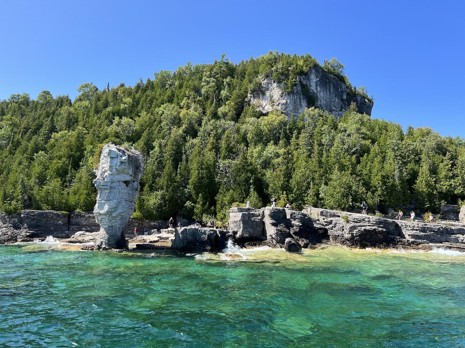
People congregate around the Big Flowerpot (a type of sea stack) on Flowerpot Island in Fathom Five National Marine Park near Tobermory, Ontario/Jennifer Bain
Perched on the rocky shore of a wilderness island in Georgian Bay, two “flowerpots” stand a respectful distance from each other, oblivious to the crowds surrounding them and the commotion they have caused for two centuries. These gravity-defying, some say mythical, sea stacks were formed when lake erosion “ate” at either side of stronger parts of the rock and eventually left the pillars isolated on the shore. Isolated in a geographic sense, yes — but rarely alone.
When surveyors spotted these garden pot-shaped beauties with wide tops and narrow bases in a shipping channel near Tobermory, Ontario in the early 1800s, they dubbed the island Flowerpot. People knew they were something special, and around 1930 the island was purchased to become part of a national park. People have been chartering boats to see what has become known as “Big Flowerpot” and “Small Flowerpot” ever since.
The flowerpots are now protected by Parks Canada as the iconic feature of Fathom Five National Marine Park. In Tobermory, the marine park shares a visitor center with its terrestrial sibling, Bruce Peninsula National Park. Outside there's a viewing tower and forest trails to the water but inside, at the Life on the Edge Gallery, a fun interpretive sign muses about why we adore flowerpots.
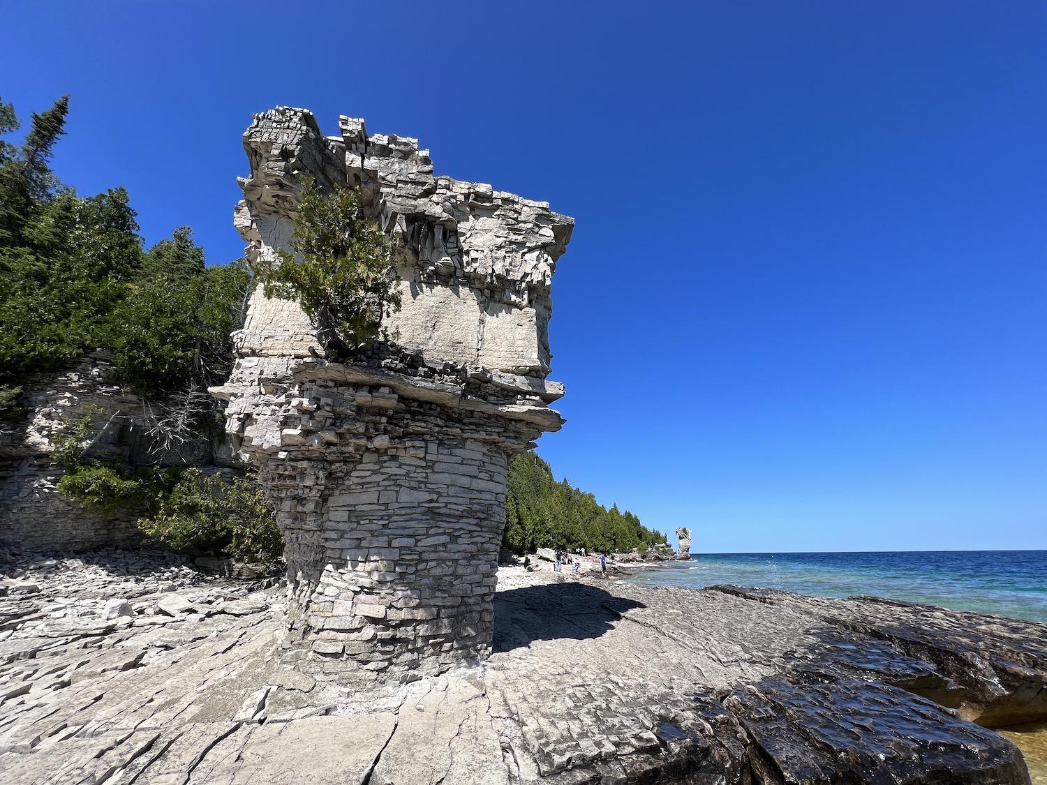
Small Flowerpot stands on the shore of Flowerpot Island in front of Big Flowerpot, and you must wait your turn to try for a photo without other people in it/Jennifer Bain
“Maybe because they are the `Rembrandts’ of erosional features,” it suggests with a nod to the Dutch painter known for his theatrical use of light and shadow. “The escarpment is a gallery of this stuff.”
The escarpment in question is the Niagara Escarpment, a rocky ridge of cliffs and rugged slopes that runs in Ontario from the Niagara River to these two parks and north to Manitoulin Island. Flowerpot Island is actually part of the UNESCO-protected escarpment, and its high bluffs were once coral reefs in a tropical sea.
Before finally seeing the flowerpots, I linger by a photo of the first known painting of them by a European. It’s also in the visitor center, part of dated interpretive signage and not a full-fledged reproduction. Apparently when Lake Huron was first surveyed in 1815, cartographer Emeric Essex Vidal was so struck by the unusual rock pillars found near where the lake becomes Georgian Bay that he produced a rather dreamy watercolor of them flanking a schooner. The painting lay forgotten in family papers until 1996 and is now safely stored at the Library and Archives Canada in Ottawa.
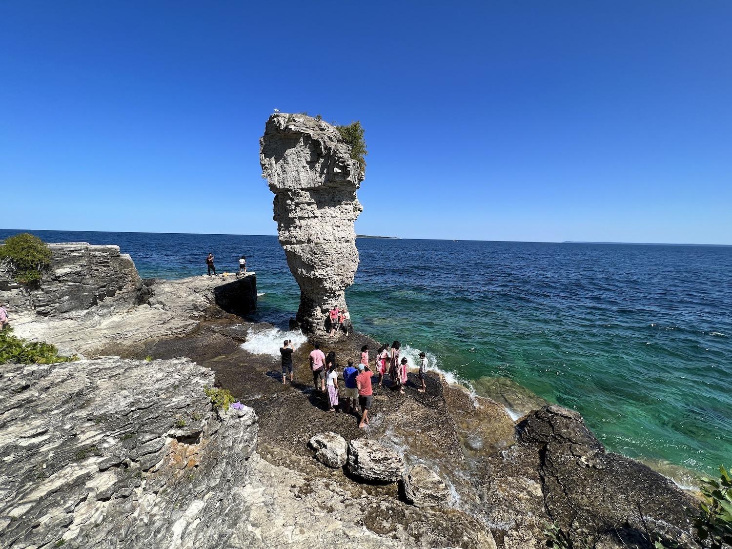
Everyone wants a photo of themselves with the Big Flowerpot on a busy August weekend at Fathom Five National Marine Park/Jennifer Bain
I get a crash course in geology, learning that the mound of dolomite rock that is Flowerpot Island was strong enough to survive the grinding of the last glacier. Its bluffs, overhangs and caves were formed after the ice mass retreated about 12,000 years ago and the area was covered by a glacial lake. As lake levels fell in stages, waves and ice eroded the bedrock cliffs, removing weaker, thin-bedded rocks and enlarging cracks. Sea caves formed where the wave zone remained stationary for relatively long periods of time. Parks Canada refers to the flowerpots as "limestone erosive formations."
The Indigenous people who lived here first — and the Europeans who came after — have long fished the waters of Lake Huron at the mouth of Georgian Bay. It's the traditional territory of the Saugeen Ojibway Nation. A commercial fishery mainly targets lake whitefish. As well, the bones at least 22 shipwrecks lie scattered throughout these cold, clear waters.
When Tobermory became a hotspot for the emerging sport of scuba diving in the 1960s, the idea for an underwater park took hold.
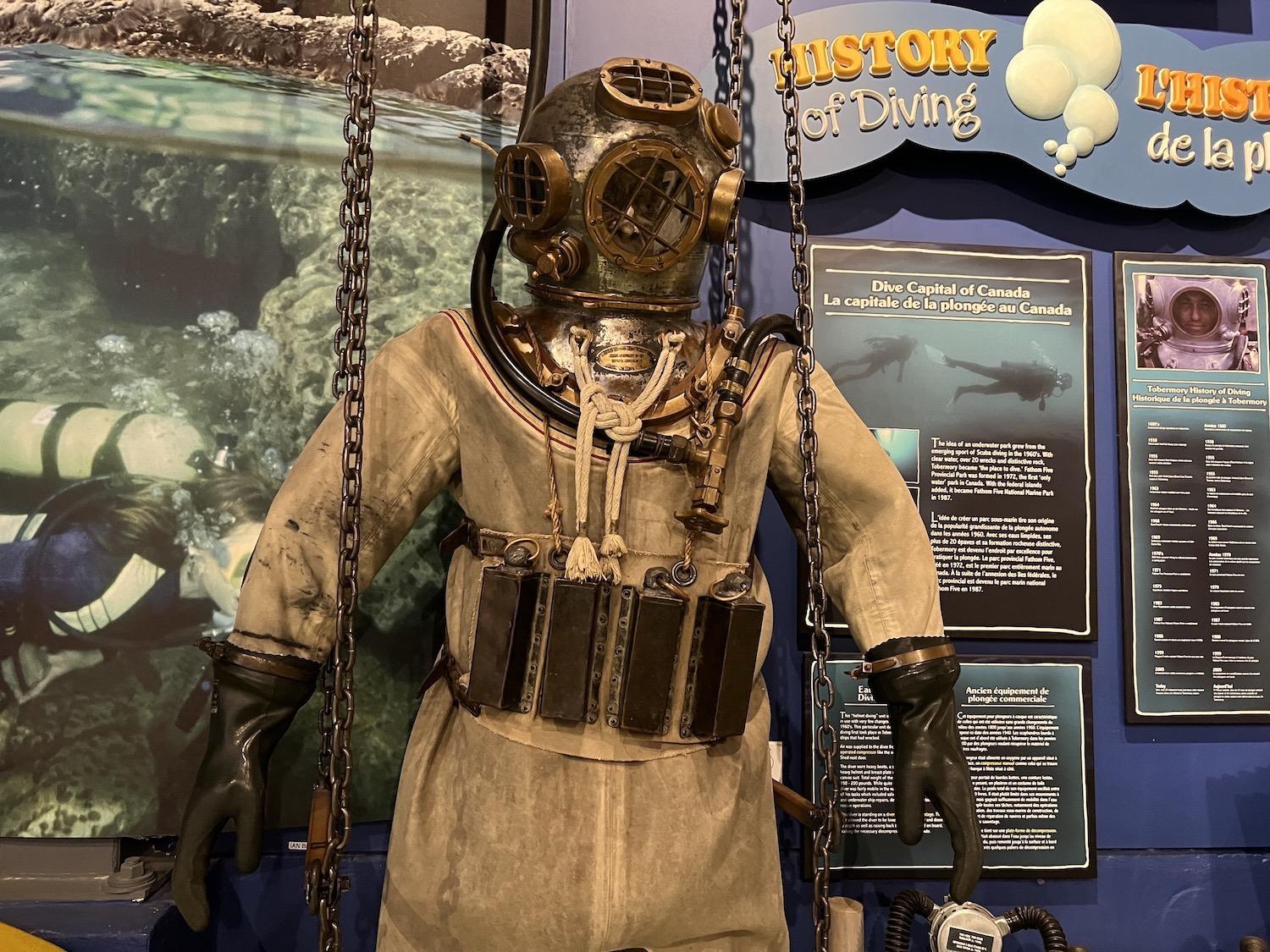
Tobermory has long attracted divers and vintage gear is on display at the Parks Canada visitor center for Bruce Peninsula National Park and Fathom Five National Marine Park/Jennifer Bain
Fathom Five Provincial Park formed in 1972, taking its name from the Ariel’s song passage in Shakespeare’s play The Tempest. A fathom is a nautical unit equivalent to about six feet that was once used to measure water depth with a sounding line.
In 1987, the provincial park and an archipelago of uninhabited but federally protected islands including Flowerpot merged to become Canada’s first national marine park. This happened before the establishment of National Marine Conservation Areas. Because the lakebed and water column have still not been transferred from the province, Parks Canada manages Fathom Five within the spirit of the Canada National Marine Conservation Areas Act, and Flowerpot Island is also managed under the jurisdiction on the Canada National Parks Act.
Much of Fathom Five is underwater and the park protects nearly two dozen shipwrecks, three historic lighthouses and 22 islands that are part of traditional Anishinaabe routes across Georgian Bay. The Chi-Cheemaun, a vehicle/passenger ferry to Manitoulin Island, crosses these protected waters. A number of operators have Parks Canada business licenses to provide services including boat shuttles to Flowerpot Island, boat tours of the marine park, dive and snorkelling charters, guided paddling tours and paddle sport rentals.
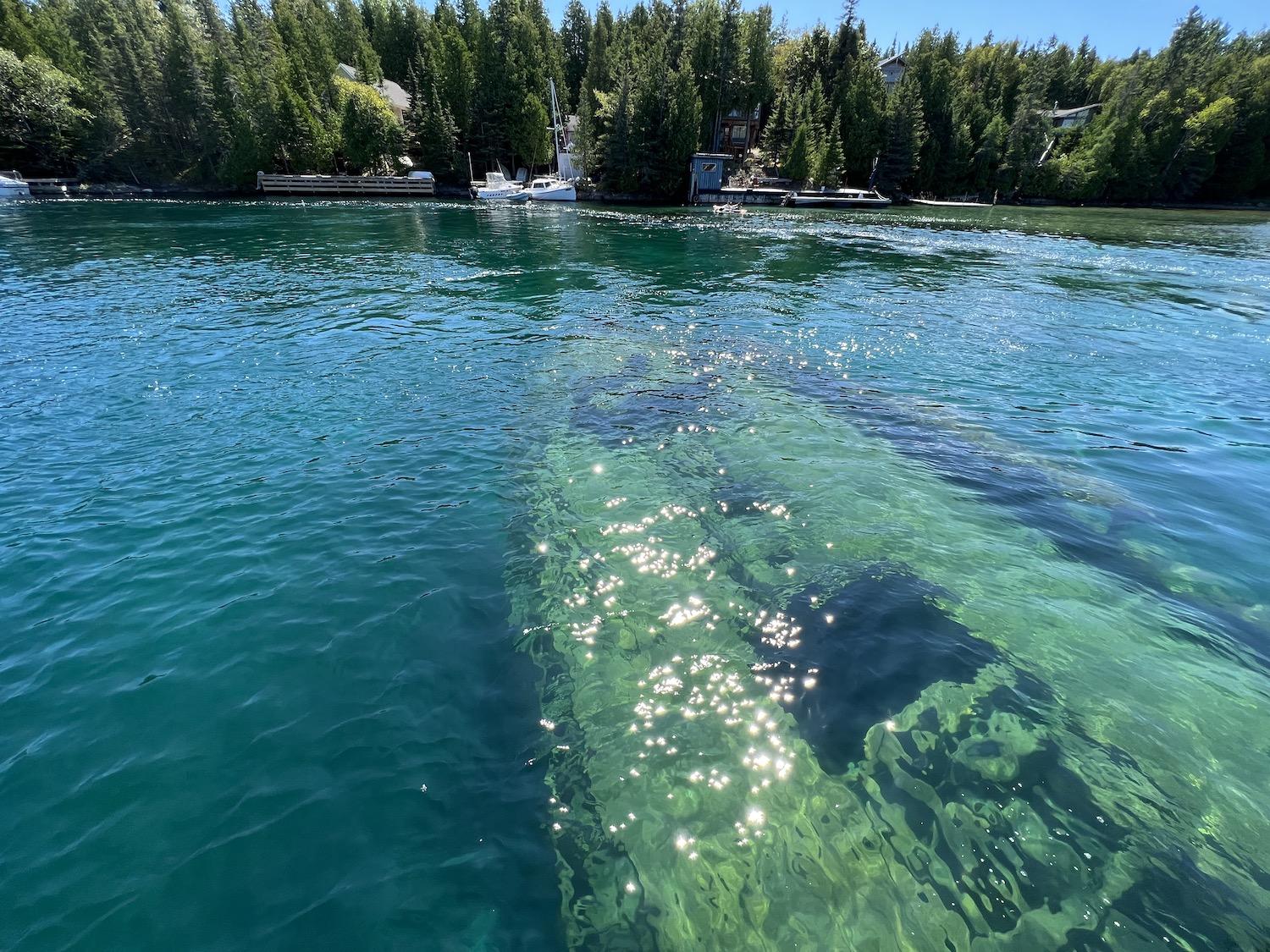
On a glass-bottom boat with Blue Heron Cruises, we hovered over the 1885 wreck of a schooner called the Sweepstakes in Big Tub Harbour/Jennifer Bain
To get to Flowerpot Island, I drive four hours north from my home in Toronto and then must decide between Blue Heron Cruises or Bruce Anchor Cruises. Both offer non-stop scenic cruises by the flowerpots, and drop-off cruises that take you over the 1885 shipwreck of a schooner called the Sweepstakes in Big Tub Harbour, and then past two lighthouses and the flowerpots before leaving you on the small island for several hours. The ticket includes a small charge of about $7 ($5 USD) that goes to Parks Canada (but if you have an annual Discovery Pass you can get that fee refunded).
As we cruise by the flowerpots on a glorious Sunday in August, we see reams of people taking turns getting selfies with the iconic rocks before fanning out along the shore to picnic and sunbathe. It's too crowded for my liking, but not unexpected. Fathom Five and Bruce Peninsula attract about 900,000 visitors a year, generating more than $129 million ($95 million USD) in economic activity in the region. In 2017, Parks Canada placed an interim limit of 1,000 visitors on Flowerpot Island at one time, and more recently decided that 650 is a more appropriate number, according to its 2021-2026 Visitor Use Management Plan for the island.
The dock area at Beachy Cove is a well-oiled machine as the cruise companies take turns dropping off and picking up passengers. The first thing you'll see is a map of the island that shows the all-important flowerpots, one accessible cave and Flowerpot Island Lightstation, run by the Friends of the Bruce District Parks Association. It also details four trails — Lighthouse, Lightstation Lookout, Mountain and Marl Bed Side. Combined, they total just 3.8 kilometres (2.4 miles) so there’s plenty of time to do them all in the 2.5 hours I get to explore before my return boat trip.
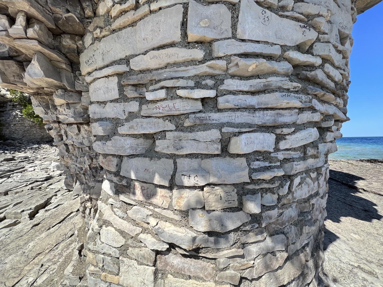
You can see repairs to the base of the Small Flowerpot that were done in the 1940s and 1950s. Parks Canada now has a non-intervention policy/Jennifer Bain
I take special note of a warning sign about building inuksuit — the human-shaped rock piles found in the vast, treeless Arctic that provide messages and directions.
“Whatever the reason, it seems that many visitors, local and from afar, cannot resist the urge to build these small human-like stone cairns, which park staff then remove,” Parks Canada signage laments. “Inuksuit are out of place and out of context, and are being built in such high numbers that they now deface much of the shoreline. Stone by stone, the naturally terraced beaches are eroded, and ancient archaeological sites are destroyed.”
I don't see inuksuit, but also don’t spend much time along the crowded shoreline. But I do check out the masonry work on the flowerpots that was done in the 1940s and 1950s to protect them from erosion. Concrete was put on their tops to “cap’’ them and prevent water from getting into the cracks, Parks Canada explains. Limestone brick work was installed around the narrowest part of the bottom of the flowerpots. Parks Canada no longer intervenes "in the natural weathering/erosion process of the flowerpots and will let nature take its course."
I visited New Brunswick's Bay of Fundy to see flowerpots (sea stacks caused by tidal erosion) at Hopewell Rocks Provincial Park before rock collapses in 2016 and 2017, and before the iconic Flowerpot Rock along the Fundy Trail Parkway was toppled in a 2022 storm.
I use my time on the 618-acre Flowerpot Island to climb the stairs to see a forest cave, admire the lightstation and hike through the woods and past the island's six tenting sites. The further I get from the flowerpots, the quieter it is. It’s not the right season for White Trilliums (Ontario’s provincial flower) and I don’t spot the rare Calypso Orchid. I do avoid stable flies, which apparently look like houseflies, breed in decaying vegetation on the shoreline and have a vicious bite.
In 2019, 131,485 people visited this island. Commercial boat tours run May to September between 9 a.m. and 7 p.m. Parks Canada limits the number of people on the island at one time because of problems with litter, human waste, noise pollution, vegetation trampling and damage to natural and cultural features. Many daytrippers aren't prepared for the craggy shoreline and cobble beaches and twist ankles. Parks Canada yearns to draw visitors who are keen to learn and do a "deep dive" into the island instead of just the "selfie at Flowerpot" crowd.
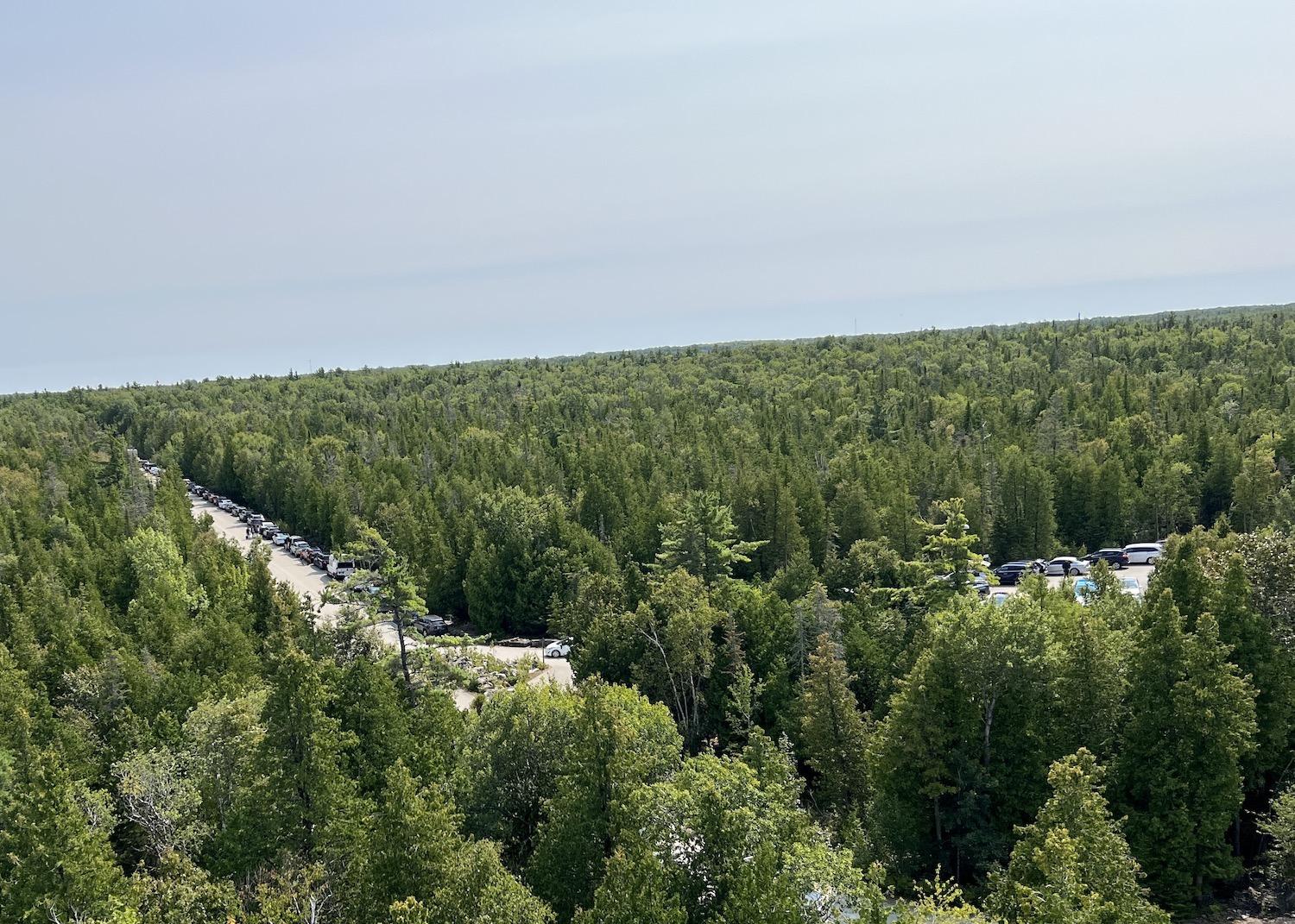
From a viewing tower you can see how the visitor center parking lot for Bruce Peninsula National Park and Fathom Five National Marine Park overflows on to the road/Jennifer Bain
On the boat back to Tobermory, surrounded mainly by multi-generational South Asian and Chinese families, I see first-hand how this place is a big draw for urban and new Canadians. The Upper Bruce Peninsula is on the doorstep of Greater Toronto and southern Ontario — Canada’s most populated area and home to about 13 million of our 38 million people. Most people daytrip here, but some, like me, stay a night or two.
Painters, photographers and regular citizens have long been inspired by this remarkable natural landscape — what Parks Canada now calls "the last green frontier in Southern Ontario" — but these two parks that link land and water also grapple with development pressures and crowding issues. Still, Parks Canada seems to have a good handle on things, limiting Flowerpot Island visitors and demanding timed tickets to park at the trailheads of Bruce Peninsula’s two most popular hikes — the Grotto and Halfway Log Dump — during high season.
As popular as Flowerpot Island is, it's expensive to get to (my ticket was about $85/$63 USD with tax). The Grotto is actually the region's most popular attraction. Discovery Pass holders can visit and park for free, paying just $6 ($4.40 USD) for a reservation fee. Hidden along the rugged shores, steps from the Bruce Trail (Canada's oldest and longest marked footpath), the area by Indian Head Cove boasts two sea caves, a natural arch and the Grotto plus limestone cliffs and clear blue water.
Why is the water Caribbean blue? Like a white-bottomed swimming pool, the shallow water absorbs the red, orange and yellow light waves. The blue and green light pass through the water, according to Parks Canada, and bounce off the white rocks causing the Grotto's famous turquoise glow. The water is clear because it doesn't have much plankton or sediments.
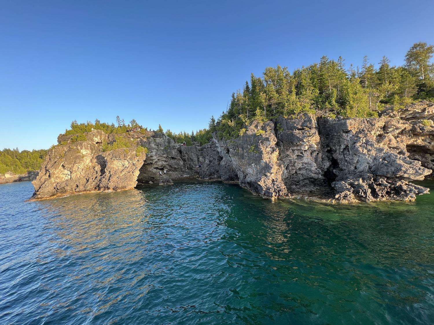
A view of people exploring the Grotto in Bruce Peninsula National Park, taken from a sunset cruise along Georgian Bay/Jennifer Bain
To get the lay of the land, I take a two-hour sunset cruise south from Tobermory along the shore of Georgian Bay, past coves with dramatic rocky beaches, a rock formation called the Beehive that’s similar to the flowerpots, and on to the Grotto. I can see why Parks Canada begs people not to swim in the cold, deep water that usually claims someone's life each year and that is considered extremely dangerous even for experienced swimmers. I can also see the appeal of spots along the shore with shallow, swimmable water.
The next morning, I return by car with my parking permit for an 8 a.m. to noon slot and get a jump on the crowds. I hike the Horse Lake Trail through the forest and along the shore to the Grotto instead of the quicker and easier Georgian Bay Trail, which I've been told is like a highway it's so crowded.
When I get to the cliffs above the Grotto, I hesitate, unsure how to best appreciate what is unexpectedly hard to see. Climbing into the pictuersque cave isn't recommended since cliff faces are rugged, slippery and unsafe. Plenty of people had climbed down the night before, but the morning crowd seems much more cautious and sensible.
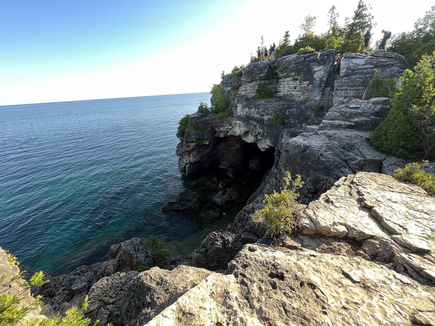
It's safer to view the Grotto from above, but it doesn't make for great photos or a full understanding of its beauty/Jennifer Bain
“I’m trying to take in the moment,” one man says with glee, standing on a cliff and looking down at the grotto.
“Take a photograph, too,” his girlfriend sternly replies.
When I crouch down by the edge of a cliff to take my photos, my water bottle tumbles out of my backpack, ricochets off several rocks and plummets into the water at the Grotto's entrance.
"See — that's what I have been trying to tell you," a mother tells her nine-year-old daughter who has been unsuccessfully begging to climb down to the Grotto. "It only takes a second for something to happen. It's very dangerous here."
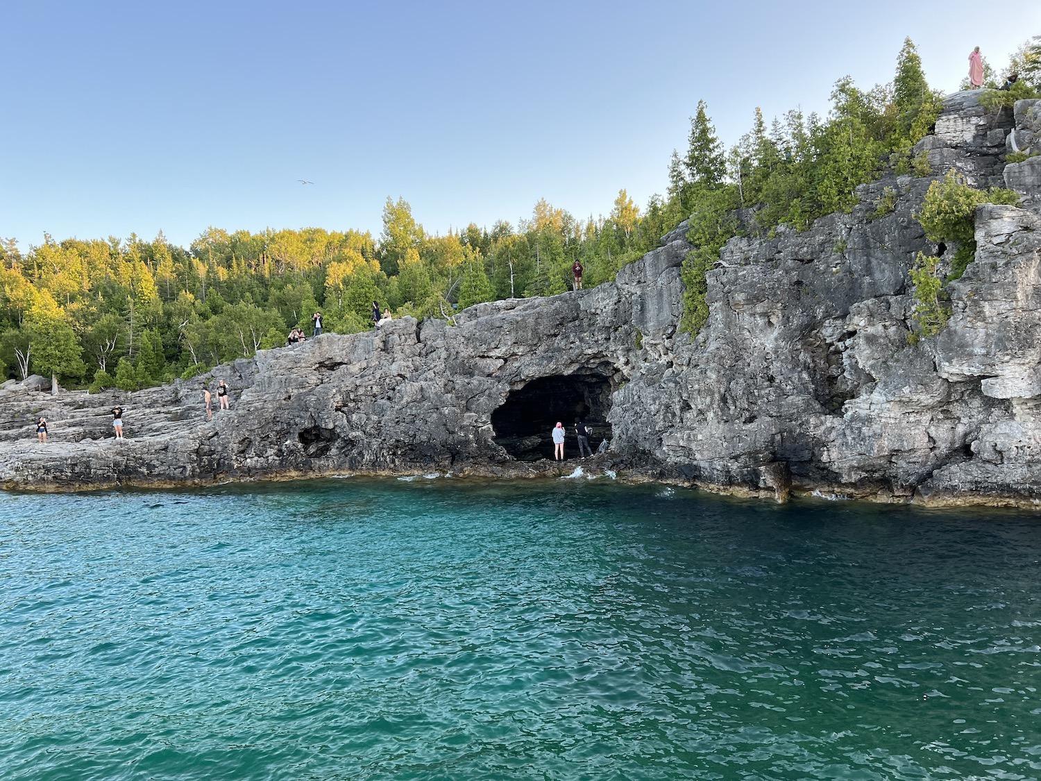
Another view from the sunset cruise of people exploring the Indian Head Cove, natural arch and Grotto of Bruce Peninsula National Park/Jennifer Bain
I call it a day and hike "the highway" back to my car. To be honest, I'm much more taken with the Singing Sands area of the park. For that, I arrive at 8 a.m. another day to nab a parking spot because I've been warned that families love the sandy beach with warm, shallow water and, unlike the visitor center, vehicles can't park along the road when the lot is full.
This spot was saved from development when the Federation of Ontario Naturalists (now Ontario Nature) rallied in 1972 to purchase this prized beach and dunes at Dorcas Bay (Singing Sands). It's on the Lake Huron side of the peninsula and showcases a delicate wetland that's home to some of the park's 34 species of orchid as well as carnivorous plants like the Pitcher Plant.
I stroll along a short boardwalk through a "wet meadow" known as a fen, and take a moment to commune with red squirrels and green frogs. Then I follow the Wild Garden Trail — with a few wrong turns thanks to confusing rope barriers and poor signage — to an alvar, a strange and globally rare habitat.
Alvars feature exposed limestone bedrock with thin soils but plenty of mosses, lichens and grasses and some rare flowers. “In a year," Parks Canada signage explains, "conditions swing from flooded to parched, from furnace to freezer.” Alvars contain a remarkable variety of species, many rare or far from their normal ranges. I'm disturbed to learn that trees, stunted and battered, have been unfortunately targeted by “bonsai” collectors.
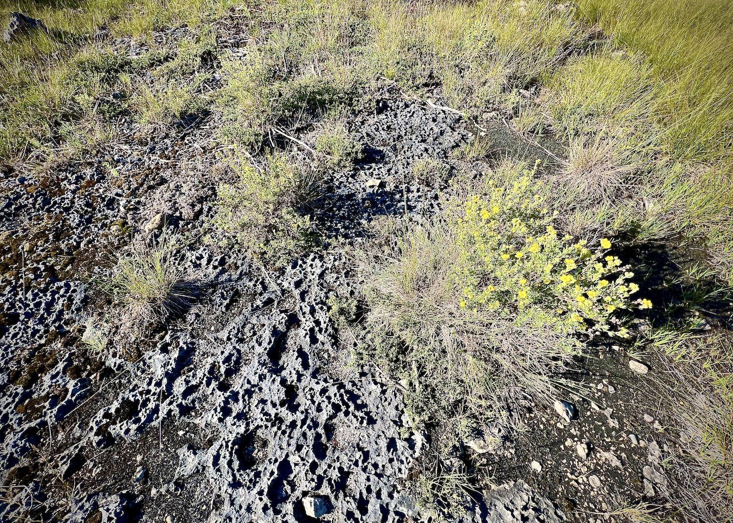
Shrubby Cinquefoil grows on an area of alvar at Singing Sands in Bruce Peninsula National Park/Jennifer Bain
Alvars are easily overlooked. But these miniature worlds that appear barren and rocky might be full of Blue-eyed Grass, Harebells, Calamint or Round-leaf Ragwort. Eastern massasauga rattlesnakes, an endangered species, use alvars to hunt mice.
Parks Canada interpretation staff tell me how to find the Singing Sands alvar (it's not marked on the map) and, admittedly, it doesn't look like much. But I read with interest how pools of water collect in slight depressions in the surface of the rock "pavement" after rain and spring snow melt. And I learn how small amounts of sand and silt accumulate and provide a habitat for plants that endure "the most extreme hardships that the seasons can throw at them; frozen in winter, baked dry in summer, flooded in springtime."
All I can identify is Shrubby Cinquefoil, with its bright yellow flowers that bloom well into September, but I'm racing the clock to get to a guided hike about snakes and don't have time to linger. Besides, I realized I really need an expert to bring this place to life. There are unmarked alvars across the park and, now that I've finally seen the iconic flowerpots and famous Grotto, that gives me a compelling reason to return one day.
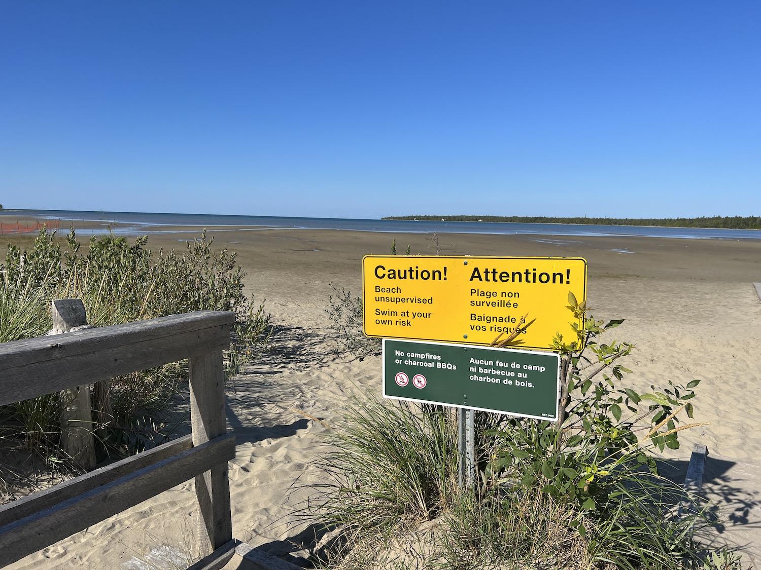
On the Lake Huron side of Bruce Peninsula National Park, people love to swim in the warm, shallow water at Singing Sands Beach/Jennifer Bain


