
Park Ranger Abby Wines stands in a damaged section of Daylight Pass Road on August 22, 2023. This was two days after flash floods triggered by the remnants of Hurricane Hilary/NPS file, Nichole Andler
The National Park Service at Death Valley National Park plans to reopen Mud Canyon Road and Daylight Pass, which suffered heavy road damage from flash flooding in August, on November 1. Daylight Pass connects the national park to NV-374 and Beatty, NV. Only emergency repairs have been completed, so drivers need to use caution.
Death Valley National Park endured severe flash floods on August 20. The remnants of Hurricane Hilary dropped 2.2 inches of rain in a single day. This was the park’s rainiest day on record. That day’s rainfall was more than the park receives in an average year. Some mountainous areas in the park likely received more than 6 inches of rain that day. The mountains’ steep rocky slopes absorbed little of this rain. Most of it channeled into canyons as flash floods.
Floods damaged the park’s utilities, some buildings, and all 1,400 miles of paved and unpaved roads in Death Valley. Undercutting of pavement and pavement loss made travel conditions unsafe. Additionally, four utility systems were compromised by debris that moved during the flash flooding, dislodging water and wastewater pipes and impacting a well.
Spewing from canyons, gullies, and washes, the floodwaters with their muddy slurries temporarily created lakes and ponds in Devils Cornfield, the Mesquite Flats Sand Dunes, and at Badwater, which is the lowest point in North America at 282 feet below sea level. Brown waterfalls and streaming torrents swept across several places along California 190, which runs east and west across the park from Panamint Springs to Death Valley Junction, and at Zabriskie Point.
The runoff also recharged the Amargosa River, an intermittent stream that drains into Badwater Basin.
The emergency repairs of Mud Canyon Road and Daylight pass were funded by the Federal Highway Administration’s Emergency Relief for Federally Owned Roads program. A contractor cleared rocks and gravel off the road, filled in shoulder drop-offs, removed damaged pavement, and filled in collapsed road segments with gravel. A second contract will start in a few months to do permanent road repairs, including repaving and selective armoring to protect roads from future floods.
The park’s hotels, largest campgrounds, primary viewpoints and hikes are open. Drivers should expect gravel patches on paved roads and to encounter traffic delays due to continuing construction parkwide. Most of the park’s secondary roads and backcountry remain closed due to flood damage. Information is on the park’s website.
“It’s an exciting time to visit the park,” said Superintendent Mike Reynolds. “How many people can say they’ve seen a lake in Death Valley? It’s really beautiful.”
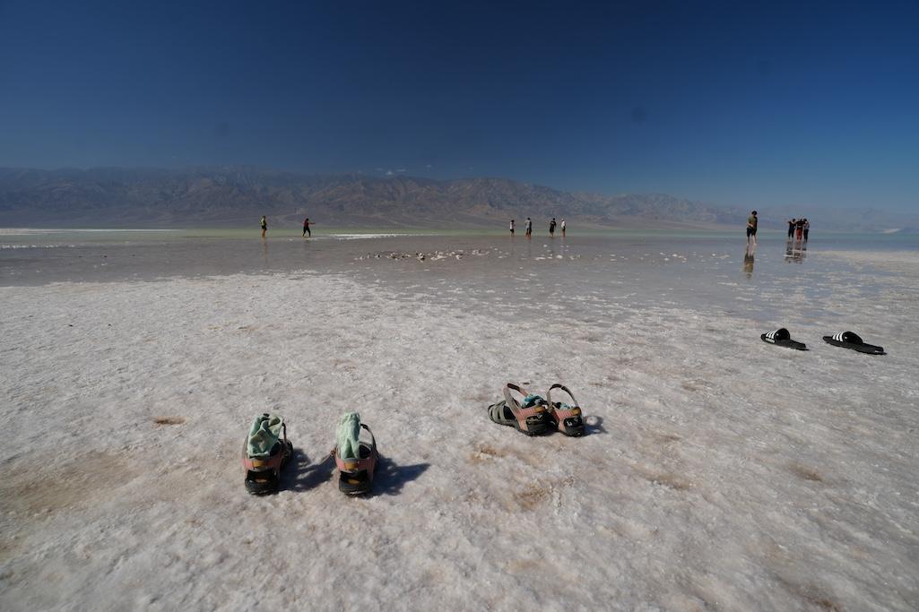
Park visitors enjoying the rare shallow lake at Badwater on October 26/NPS, Elyscia Letterman

