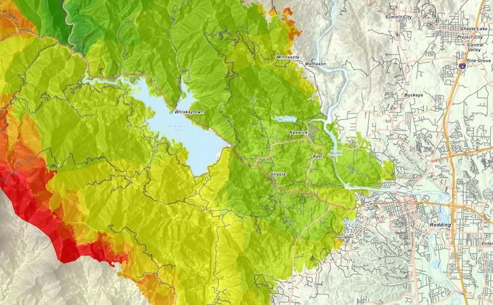
A closeup of the Carr Fire map released Sunday morning/CalFire
Whiskeytown National Recreation Area, a rumpled landscape in northern California where the National Park Service and U.S. Forest Service share management responsibilities over 42,500 acres, has closed due to the Carr Fire with no reopening date on the horizon.
In a short post on the NRA's website, staff said simply that, "Whiskeytown is closed to all visitors and non-essential personnel due to the Carr Fire, which is actively burning in the park and neighboring communities. Highway 299 is closed at Buckhorn to the west and I-5/Buenaventura in Redding to the east."
But a story in the Redding Record Searchlight on Saturday cast a more somber portrait of the devastation left behind by the fire in and around the NRA.
Some of Redding's favorite recreation areas — including a renowned network of mountain bike trails — won't be safe to visit anytime soon in the aftermath of the Carr Fire. Whiskeytown National Recreation Area, which last year drew more than 832,000 visitors who spent over $35 million in nearby communities, is closed for the summer and likely longer.
The fire, which covered more than 154,000 acres Sunday morning and was 41 percent contained, had burned down bridges in and around the area.
"A trail itself can't burn — it's dirt — but everything else around it can," Nathan Knudsen, executive director of the Redding Trail Alliance, told the newspaper. "We just have to wait for government agencies to evaluate the destruction."
The Whiskeytown Unit of the NRA is managed by the National Park Service. The main attraction there is Whiskeytown Lake, where visitors come to water-ski, kayak, canoe, sail and fish. Mountain biking is allowed on most of the hiking trails that thread through the unit, which is 8 miles west of Redding. Highway 299 is where the fire erupted on July 23, ignited by a spark created when a tire on a trailer went flat and the rim kissed the pavement. Since that date the fire has grown exponentially, across and around the Whiskeytown Unit. Burning in steep drainages, the flames have been fanned again and again by strong winds.
"Hot, dry, and unstable conditions are expected for today," read Sunday morning's fire briefing.
At least seven people have been killed by the fire.

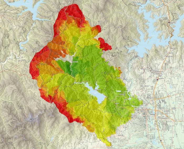
This map of the Carr Fire reflects the progression of the blaze, with green shaded areas the opening days of the fire, and the red areas mapping the blaze on August 3/CalFire


Add comment