Growing pressures between wildlife and humans along the Moose-Wilson Road -- among other issues -- have Grand Teton officials studying the best way to manage the road/NPS
A wonderful stretch of backroad in Grand Teton National Park is the Moose-Wilson Road, a narrow road -- almost a lane -- that connects the park headquarters with Wilson. It's generally quiet, attracts moose and bears, and is highly picturesque. But increasing traffic, and wildlife, are creating problems, problems that park staff hope they can reduce or eliminate with a management plan for the corridor.
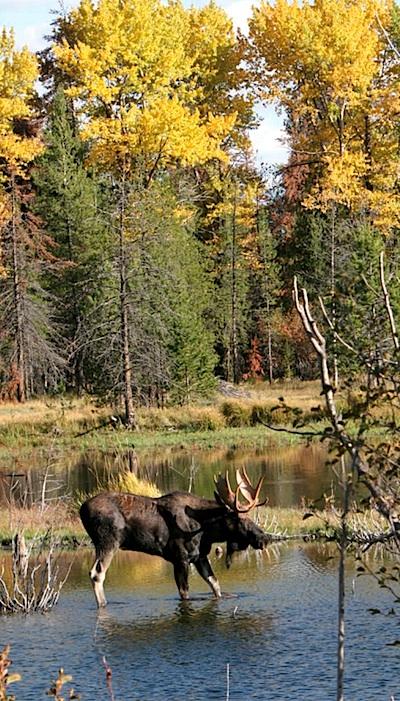
Wildlife viewing opportunities have been a special part of the experience for many visitors to the Moose-Wilson corridor, but notable increases in potentially dangerous wildlife have been observed. Species in the area now include grizzly bears as well as moose and black bears. Increased motor vehicle and bicycle traffic has complicated the management of these species and has raised concerns regarding increased interaction between humans and wildlife. Strategies are needed to manage these increasing volumes to ensure visitor safety and quality of experience, and to avoid impacts to wildlife, ecological communities, historic character, and other fundamental resources and values.
To explore the issues, and possible solutions, Grand Teton staff are circulating the beginnings of a study that will result in the Moose-Wilson Corridor Comprehensive Management Plan and Environmental Impact Statement (Moose-Wilson Corridor Plan/EIS). While this document contains four alternatives -- a no-action alternative and three others -- the park has not yet settled on a preferred alternative. The draft document is open now for public review and comment through September 15. Additionally, an open house has been set for Thursday, August28, from 4 p.m. to 7 p.m. at the Teton (Wyoming) County Library in Jackson, Wyoming.
'These preliminary alternatives serve as conversation starters and they represent a variety of possible actions that may be included in the long-term management framework for this special part of Grand Teton National Park,' said park Superintendent David Vela. 'We have not yet identified a preferred alternative, and we look forward to obtaining public input on the preliminary alternatives to help us refine them for the draft Moose-Wilson Corridor Plan/ EIS.'
Public comments may be submitted by September 15, 2014 online or by mail to: Grand Teton National Park, Attn: Moose-Wilson Planning Team, PO Box 170, Moose, WY 83012.
The three "action" alternatives currently on the board are:
* Alternative B
This concept emphasizes the corridor as a visitor destination. Reduced crowding on Moose-Wilson Road and at destinations within the corridor would provide visitors an opportunity for self-discovery. Existing development areas and facilities would be maintained where appropriate and removed or relocated in some areas to protect natural resources and processes. Ecological processes and values would be protected and restored throughout the Moose-Wilson corridor.
Key Elements
1. Realign two segments of the northern portion of the Moose-Wilson Road to address congestion associated with the presence of wildlife, wildlife habitat connectivity, and operational issues.
2. Improve the unpaved segment of Moose-Wilson Road south of the LSR Preserve by paving it and defining its width to be consistent with the rest of the road.
3. Address increases in traffic and volume-related congestion by restricting through-traffic in either direction beyond the LSR Preserve Center during certain peak periods. This would be accomplished by reconfiguring access to and parking at the LSR Preserve, and installing a gate to prevent through-traffic at certain established peak hours during the peak season, thereby encouraging use of the road only as a means to visit destinations within the corridor at those times. Through travel by bicycles would not be affected, and the road would continue to be open to motor vehicle through-traffic at all other times.
* Alternative C
The emphasis of this concept is to be a model for the balance of preservation and public use. The alternative would manage the intensity and timing of visitor use to enable experiences of physical and spiritual renewal that leads to individual responsibility for conservation stewardship. Development along this scenic route would be maintained within the existing development footprint to effectively provide high quality visitor opportunities. The sense of discovery would predominate in this outstanding and diverse natural ecosystem.
Key Elements
1. Two days per week, Moose-Wilson Road would be open only to bicycles and pedestrians between Sawmill Ponds Overlook and the Granite Canyon trailhead. The road would be open to through-travel by motor vehicles at all other times in early/mid-May through September 30.
2. In order to address congestion resulting from increases in traffic volumes, the National Park Service would limit the number of vehicles entering the corridor during certain peak periods. Hourly limits would be established to ensure that desired conditions were maintained and queuing areas would be established at either end of the road where vehicles could wait before entering the corridor.
* Alternative D
The emphasis of this concept is to better integrate the Moose-Wilson area with the broader park experience and link it to the region's larger recreational network. Park management would focus on ways to welcome people; connect people with resources; and promote understanding, enjoyment, preservation, and health. To enhance the recreational scenic driving experience, strategies would be used to reduce traffic congestion. Visitors would be provided with opportunities to get out of their vehicles and experience the outstanding natural and cultural landscapes. Additional developments and concentrated visitor use in the corridor would be located in focused areas.
Key Elements
1. Realign two segments of the northern portion of Moose-Wilson Road to address congestion associated with the presence of wildlife, wildlife habitat connectivity, and operational issues.
2. Construct a multiuse pathway parallel to Moose-Wilson Road between Moose and the Granite Canyon Entrance. The pathway would be generally within 50 feet of the existing or realigned segments of the road.
3. In order to address congestion resulting from increased traffic volumes, the National Park Service would limit the number of vehicles entering the corridor during certain peak periods. Hourly limits would be established to
ensure that desired conditions were maintained, and a reservation system would be implemented to manage the number of vehicles entering the corridor when necessary.
You can find more details of the draft proposal at this site.
At the National Parks Conservation Association, officials were happy to see the draft proposal, but said they would withhold endorsing any one alternative until after the environmental impact studies have been completed.
"While stage coaches on the Moose-Wilson Road have been replaced by cars over the past century, its historic values and unparalleled biological treasures remain intact and require continued protection," said Tim Stevens, the association's Northern Rockies senior regional director. "While the draft alternatives provide an important basis for discussing future management options, they do not include the science and policy-based impacts analysis that the draft Environmental Impact Statement (EIS) will provide in the coming months. As such, NPCA will not endorse a particular alternative at this point in the process. We will thoroughly review the draft alternatives and continue to advocate for the protection of the wildlife and wild places that this unique part of Grand Teton National Park is renowned for. NPCA also supports Grand Teton's continued enhancement of recreational opportunities for the park's 2.6 million annual visitors.'
In addition to the development of preliminary alternatives, Grand Teton has contracted for visitor use studies to be conducted by Utah State University and Pennsylvania State University. These studies are currently underway to gather social science information and visitor use data that will further inform the planning process and help refine management alternatives. Fieldwork on these studies will conclude this fall.
The Moose-Wilson corridor consists of a seven-mile-long, quaint, country road that provides access to numerous destinations. Those include the Murie Ranch, the Laurance S. Rockefeller Preserve, and the Death Canyon and Granite Canyon trailheads. Changes such as increased vehicle traffic and congestion, bicycling, human/wildlife interactions, and impacts from expanding visitor use prompted the need to take a comprehensive and science-based look at key issues affecting the exceptional corridor and analyze ways to appropriately reduce adverse impacts to natural and cultural resources found within this special area of the park.


Add comment