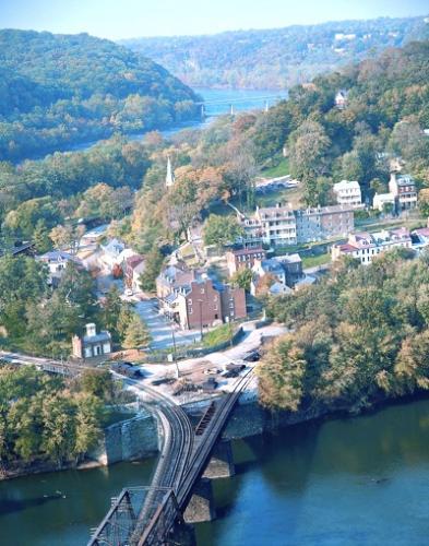
The waters that flow past Harpers Ferry National Historical Park in the Shenandoah and Potomac rivers will rise again, to record levels, and with that in mind park officials are preparing their response plan for the next big flood.
It was nine years ago that the park last updated its flood response plan, and with recent weather events in mind, officials have been working on another update so they'll be able to save valuable museum artifacts and exhibits that lie in the flood plain.
According to museum curator Michael Hosking, the town of Harpers Ferry, West Virginia, has had 55 recorded floods since 1748. According to the National Weather Service, the worst of them was in 1936 when the two rivers crested at 36.5 feet; the highest in recent years occurred in 1996, when the crest reached 29.8 feet.
Of the historic floods, nine occurred in March, six occurred in April and May, and five occurred in October, according to park officials. Interestingly, July is the only month with no recorded floods. With the strange weather patterns the country has experienced recently, the question arises as to what is in store for Harpers Ferry this year?
The National Center for Atmospheric Research’s “Current Extreme Weather and Climate Change” report states that “heat waves are longer and hotter” and that “heavy rains and flooding are more frequent.”
Recognizing that new weather patterns are developing, staff at the historical park are not sitting by idly waiting for the next flood. With the early weather events this year and the unknowns that this summer will bring, key staff members are looking carefully at the park’s flood response plan and using this plan to have discussions on what to do when the rivers again rise.
Last year the park had a couple of close calls, beginning discussions on evacuating the museums along the two rivers – but luckily nothing came from these river rises. It’s only a matter of time, though, when park staff will have to implement this plan again to evacuate the ten museums located along Shenandoah Street as well as the Harpers Ferry Historical Association bookstore, which is in line to be one of the first buildings inundated by flood waters.
Park staff are actively looking at the areas potentially affected by the floods, assessing the time that it will take to evacuate these location as well as refreshing their memories on how the exhibits are constructed and ensuring that they may be disassembled carefully to protect any museum objects in the exhibit as well as protecting the exhibit panels and other exhibit aids.


Add comment