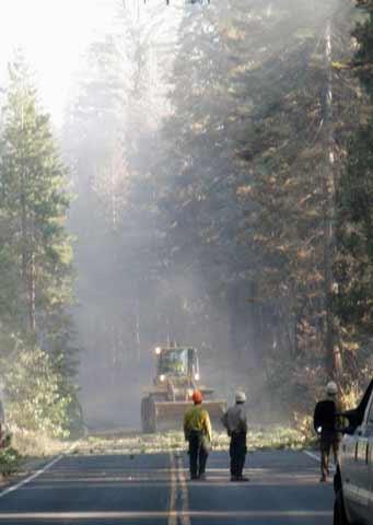
The Big Meadow fire in Yosemite National Park is listed as 100% contained, and two road closures on the Big Oak Flat Road are ending. Here's an update from the park on roads, trails and other facilities in the park affected by the fire.
The Big Oak Flat Road from Crane Flat to the El Portal Road is scheduled to re-open at 5:00 p.m. Tuesday, September 8. The road, which has been closed since Wednesday, August 26, due to the Big Meadow Fire, allows visitors to enter Yosemite Valley via Highway 120 from Groveland.
The road from Big Oak Flat Entrance Station to Crane Flat and across Tioga Pass re-opened on Sunday, September 6, making through travel possible between Groveland and Lee Vining.
Tamarack and Crane Flat Campgrounds remain closed, as do the following trails: Old Big Oak Flat Trailhead to El Capitan; Rockslides to El Capitan; and Tamarack Creek to El Capitan.
If you're going to be visiting the park in the next few days and aren't sure about the location of any of the roads or other facilities mentioned above, you can download maps of the park here.
Hazard tree cutting and debris removal will continue along the Big Oak Flat Road during the day on Tuesday until the road opens. Firefighters are patrolling all areas of the fire to mop up hot spots, restoring trails and fireline to their natural condition, and packing out hose and other firefighting equipment.
Yosemite National Park Acting Superintendent Dave Uberuaga said,
“Working under difficult conditions, the fire crews demonstrated ingenuity, determination, and painstaking attention to safety in finishing the task of making the Big Oak Flat Road through Yosemite National Park safe again for travelers.”
Drivers are advised to exercise caution when the road re-opens due to smoke on the road from vegetation still burning inside the fire area. In addition, burned areas adjacent to the road remain closed to the public by order of the Superintendent as provided in 36 CFR 1.5. .
Please respect those closures of burned areas, which continue to be dangerous due to the risk of falling snags, possible hot spots, and other hazards.
For up-to-date information on road conditions at Yosemite National Park, you may call 209/372-0200 (press 1, then 1).
Recent updates on fire activity, air quality and smoke monitoring and other current conditions are available through links on the park's website.


Comments
The LA Times has a story on NPS starting its investigation of this fire:
http://www.latimes.com/news/local/la-me-yosemite-fire10-2009sep10,0,5303...
What's new to me is that they didn't actually ignite the planned fire. They started the 1 acre test fire required before , and the test fire got out of control.
Also, the full fire prescription for the Foresta area (Big Meadow was just one of the set of burns in the prescription) is posted on inciweb at:
http://inciweb.org/incident/article/9489/
I haven't the time nor the knowledge to read the whole thing. I did see a note that the Big Meadow portion needed to be burned after flowering & seed set (page 20). And page 51 notes that "Moderately intense fire behavior is needed to meet the resource objectives." From my first skim, I don't see the forms for the big Meadow burn, only those for the couple of burns completed in 2008. And, while the maps are scanned so poorly in the pdf to be almost useless, the contingency line identified in appendix G (p77) is pretty close to the final boundary of the burned area.
If Jon Keeley is right ( http://www.werc.usgs.gov/seki/pdfs/K2009_Ecological%20Fdt%20Fire%20Mgmt_... ), this type of fuel reduction burn, while still useful for ecosystem & resource considerations, has little or no value in reducing fire risk via fuel reduction in the urban wildland interface: in this case reducing the risk of subsequent fires taking out the structures in Foresta. What to do about NPS (& FS) owning fire-dependent ecosystem lands surrounding a community of cabins & homes in the woods is well above my pay grade.